")
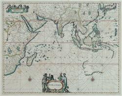
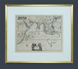
17th C MAP 'Mar di India,' c.1650.
By Johannes Janssonius (1588-1664). Hand coloured map from the 'Atlas Maritimus' showing from the Cape of Good Hope to the East Indies, including an early fragment of the south-west coast of Australia.
Copper Engraving (46x57cm)
Estimate $1,000-2,000